Integrating Remote Sensing and GIS Techniques for Flood Modeling in Sparsely Gauged Catchment
Keywords:
Sparsely gauged catchment, Flood modeling, Remote sensing, GIS technique, Kelantan River Basin, Quantitative statisticsAbstract
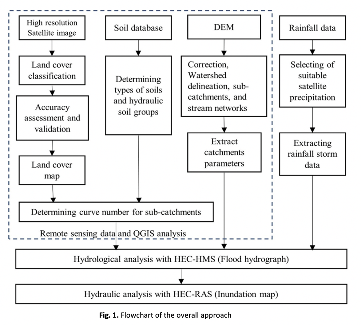
Reproducing past flood occurrences can help us better understand the behavior and patterns of floods to develop effective flood mitigation plans. However, modeling flood events at sparsely gauged catchments remains challenging due to insufficient catchment information and incomplete climate records, especially in developing countries. To address these limitations, remote sensing products have come under the spotlight due to recent advancements in satellite sensors and assimilation algorithms. This study intends to explore the feasibility of integrating remote sensing and GIS techniques for flood modeling in the sparsely gauged Lebir sub-catchment, which is the upper catchment of Kelantan River Basin in Malaysia. Four quantitative statistics were applied to evaluate the performance of flood model in simulating the hydrograph and inundation extent during December 2014 flood event. The results reveal good agreement between observed and simulated hydrographs for the Lebir catchment. The calibration of model parameters also further improves the model accuracy, indicating better simulation of the peak flow. In addition, the hydraulic model performs reasonably well in generating the inundation extent during the floods in comparison to the observed inundation level. The collective findings highlight the potential usefulness of remote sensing products when integrated with GIS techniques in hydrological modeling to achieve acceptable accuracy in sparsely gauged catchments. Future studies should explore how uncertainty properties change when propagating from precipitation data to rainfall-runoff processes.
Downloads